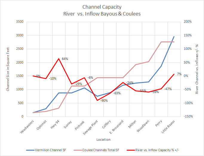
The source of this data is from a USGS survey of the river and all the connecting bayous and coulees.
Below is my graph of cumulative inflow channels sizes vs. the river channel size at nearest point using this data. Note the river channel would be diminished with current size data due to shoaling as per the August 2019 USACE survey of the river channel. Additionally, smaller inflows into the river are not included in this analysis.

